Overview |
Makran Tsunami |
Events |
Projects |
|---|
A DIGITAL ELEVATION MODEL FOR CALIBRATING TSUNAMI MODELS IN KARACHI HARBOUR
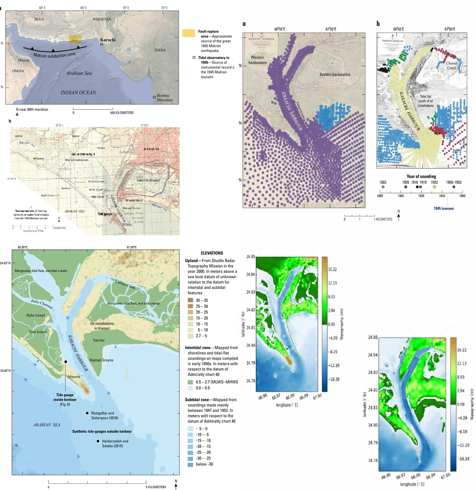
This study is focused on developing a Digital Elevation Model for simulating the 1945 Makran tsunami in Karachi Harbour. Nautical charts and topographic maps from the middle of the twentieth century allow the DEM to approximate physiography that the 1945 tsunami encountered. The compiled data is to be interpolated to convert a non-uniform distribution of points into a uniform grid. The intended application is computer simulation of the tsunami’s effects, which have been compiled elsewhere from a tide-gauge record, newspaper accounts, and testimony of elderly residents.

EARTHQUAKE & TSUNAMI HAZARD MAPPING FOR
KARACHI AND GWADAR
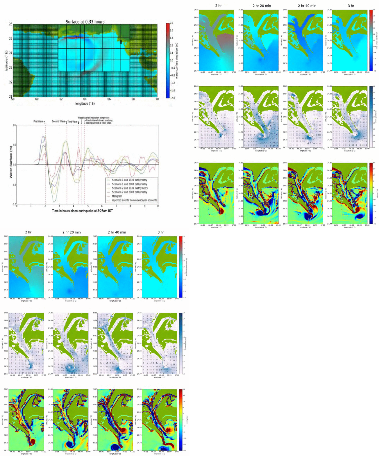
This study is focused on tsunami effects along coasts of Pakistan resulting from Tsunami currents rather than high water levels. Simulation is to be done with an open source code, Geo Claw, which uses a High resolution shock capturing finite volume method to solve the depth averaged Two dimensional nonlinear shallow water equations that are standard in modelling tsunami propagation and Inundation. Comparison of the simulated wave train and currents is to be done with the observations by an incomplete marigram from a float-type tide gauge installed at Manora Island. The primary goal is to develop a unified tsunami hazard maps for constraining the extent of inundation along the Pakistan coastline, such a map will provide a preliminary basis for tsunami response planning which includes development of detailed tsunami evacuation maps, plans and procedures.


